Lisa Falls Trip Report
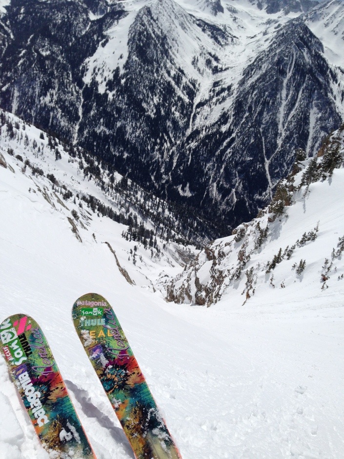
The big mama couloir of the Wasatch. It is such a beautiful line. Having skied Coalpit and Hypodermic Needle in the past month, I had spent quite a bit of time staring at it.
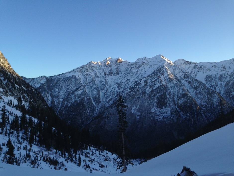
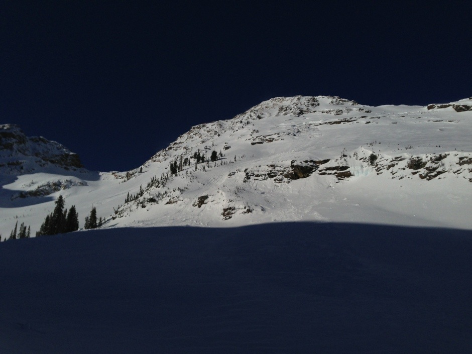
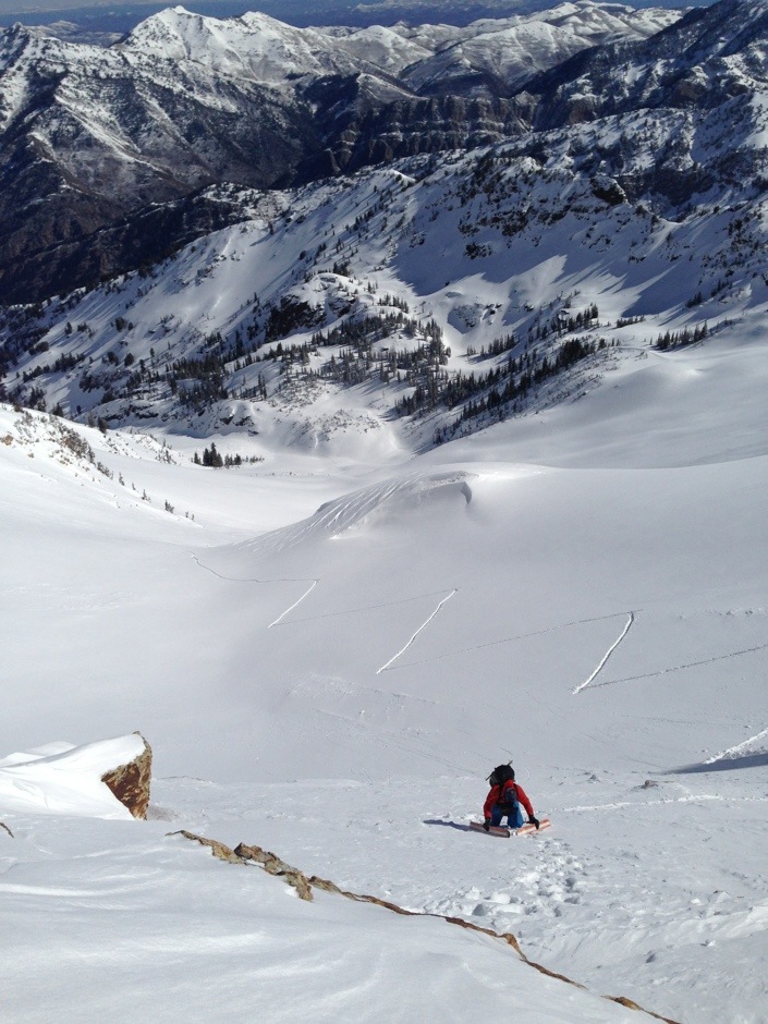
Lisa Falls shortly after sunrise.
Here’s Andrew McLean’s description of Lisa Falls from “The Chuting Gallery,”
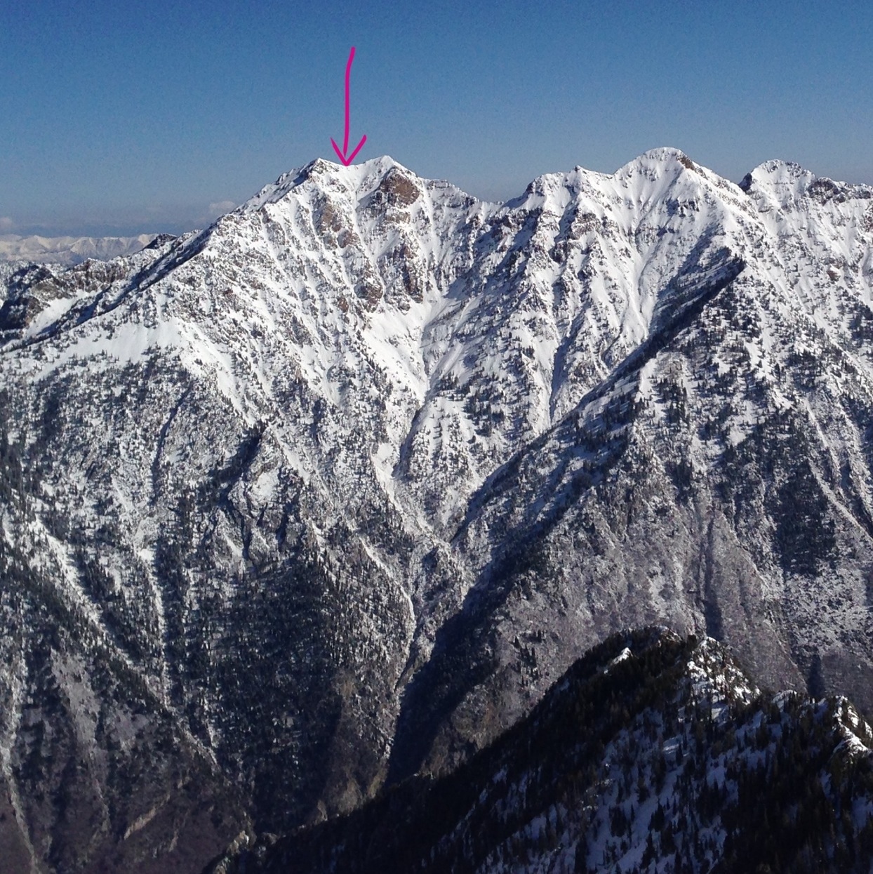
Lisa Falls (AKA The South Couloir of Twin Peaks)
Rating: S4 3 Stars
Pitch: 36-42 degrees
Exposure: SE-S-SW
Elevations: 6,500′-11,330′
Vertical: 4,830′
“One of the longest, most varied, interesting and fun chutes in the Wasatch, as well as one of the biggest undertakings. The initial 1,700 vertical feet is straight, lined with beauiful rock, a consistent 40 degrees, wide enough for a few independent lines and overall some of the best chute skiing anywhere. You then drop into a roller coaster of aprons, gullies, corkscrews and dips an drops until the run eventually becomes an unskiable creek bed. At this point traverse out to the skier’s left and begin some soul searching bushwhacking until you finally stumble out onto the Little Cottonwood road. A short section of rope is good insurance for lowering over and around obstacles.
The line starts right at the saddle between the two peaks that form ‘Twin Peaks’ (some mixed climbing may be necessary to get there) and is easy to find. The run can be approached either by going up Broad’s Fork on the Big Cottonwood side (longer but safer), booting up Tanner’s and traversing over (recommended) or going straight up the chute itself (shorter and some bushwhacking).
Since it starts so close to the beginning of the canyon and isn’t easily seen from the Little Cottonwood road, Lisa Falls is seldom shown on any of the ski touring maps. This combined with the magnitude of the approach means that few people ever ski this memorable line. You can get a great overall view of it from across the canyon in either the Hogum or Maybird drainages.”
We skied the line on Thursday, April 18, 2013. I tried to get there on Tuesday by going up Tanner’s, but we got turned around by deep wind slabs near the top. Because of that, we decided to go up Broad’s because we mistakenly thought there would be a skin track in. But it would be safer and less stressful.
We met at the mouth of Little at 5 am, dropped a car at Lisa Falls, and then went up to Big Cottonwood to start our approach, around 5:30 am. The first 30-40 minutes we were walking on dirt.
Having scouted from the Needle the previous week, I knew the line wasn’t getting sun until well after sunrise, maybe 8-9 am. The morning was January cold. I had on many layers (see end of TR for detailed gear info).
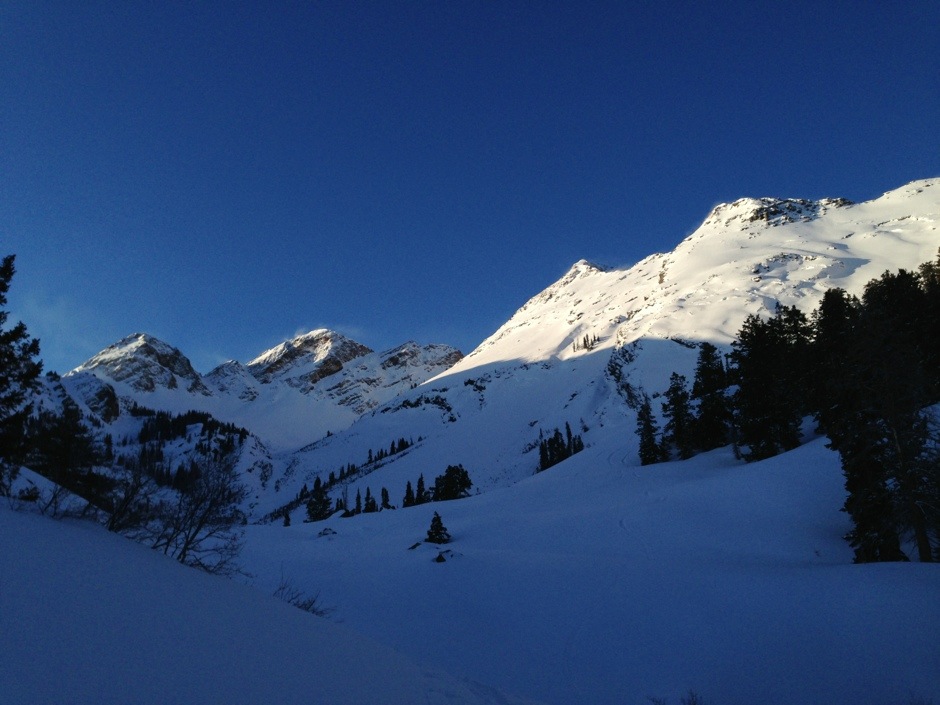
The East facing slopes getting blasted with sun and wind on the peaks.
It’s hard to tell from this picture, but if you look closely, you can see some of the yawning Glide cracks and recent debris. I was nervous as we skinned by these, but it was still early and we had a deep freeze the night before. I still put in a skin track high on the opposite side of the gully just to be safe, and we went one at a time across these sections.
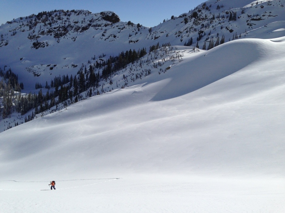
Approaching this way, we were able to see how the snow was responding to the intense April sunlight. I didn’t see a single rollerball or pinwheel as we ascended. Just cold powder, I was excited!
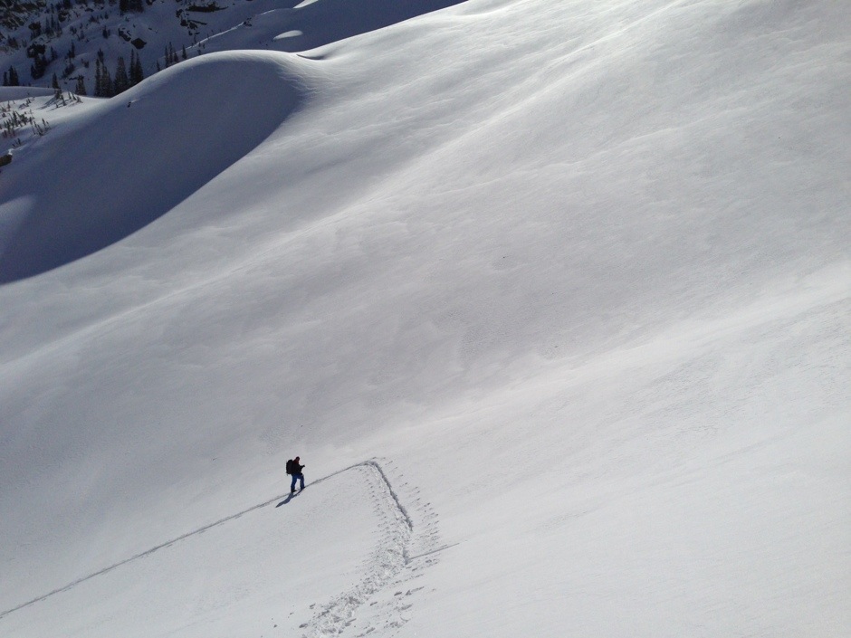
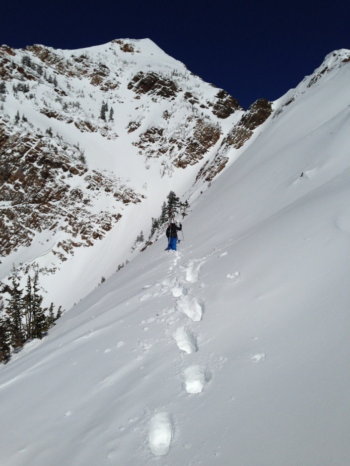
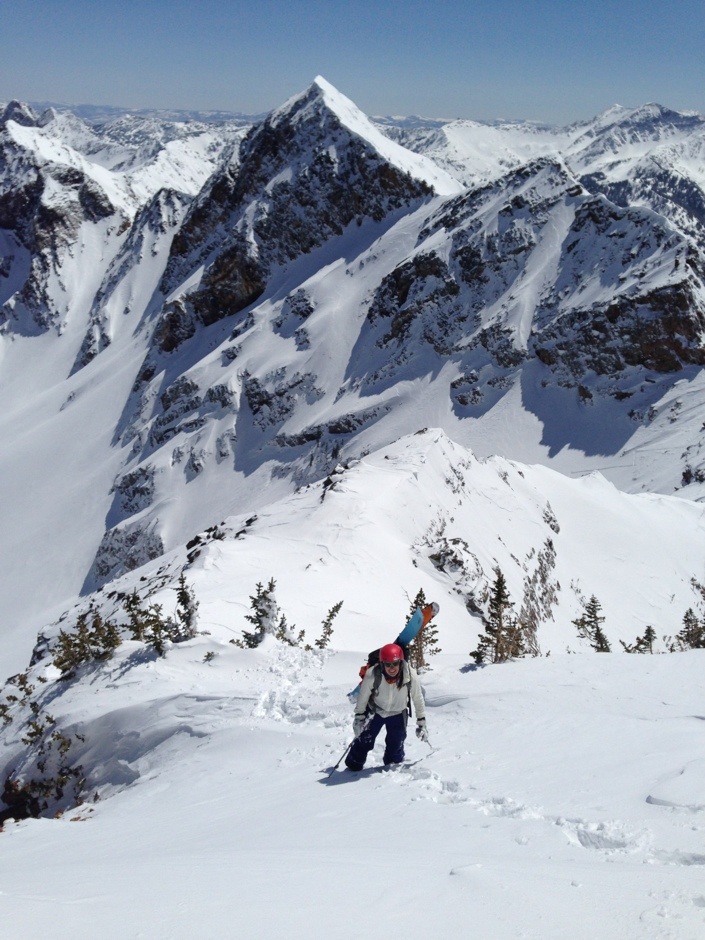
We were able to skin most of the way to the ridge, and just had to boot up one small section.
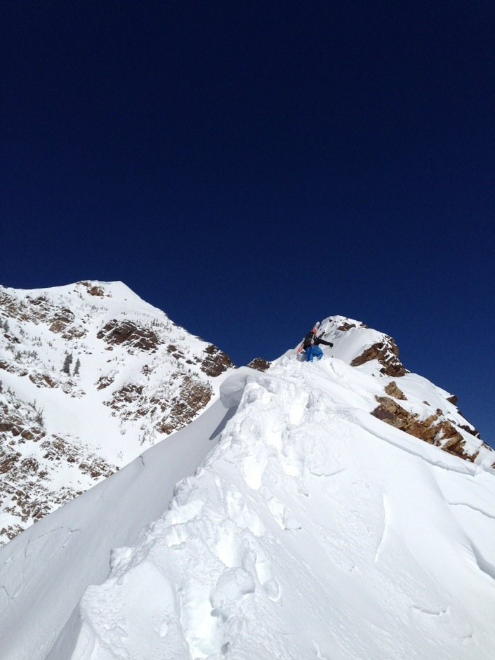
Tobias MacPhee on the beginning of a spicy ridgewalk. It was slow going because of the amount of snow and windloading. I kicked a few cornices on the way to see how the snow would react.
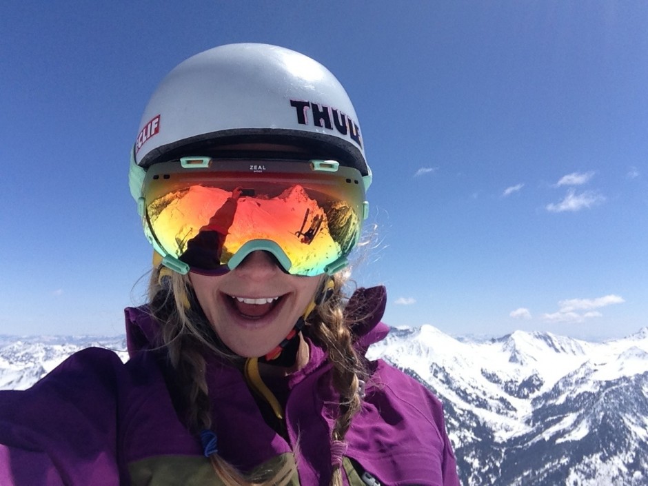
Carolyn and I enjoying the spiciness.
Instead of perservering with the ridgewalk, with its overhanging cornices and waist deep windloading, we decided to traverse over and hike up a sub-couloir that would get us to the summit. There was a sun/wind crust for the first 15-20 feet below the ridge, and then it turned into nice, soft powder. Before committing to the slope and traverse from the safer ridge, we put Tobias on a rope and belayed him across (this shot is after the belay since I couldn’t take photos and belay).
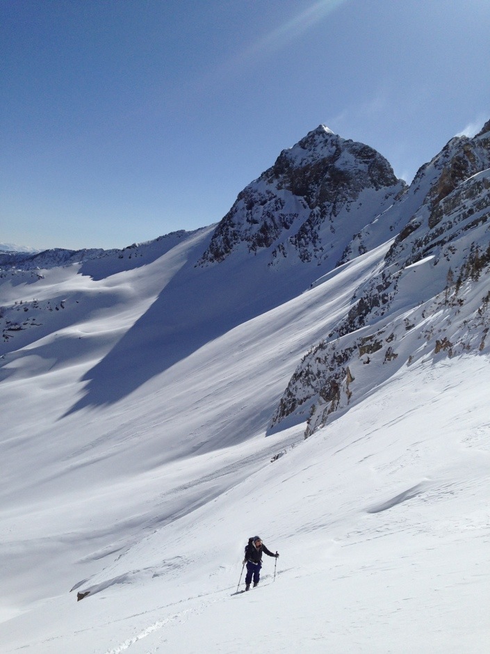
Nearing the top.
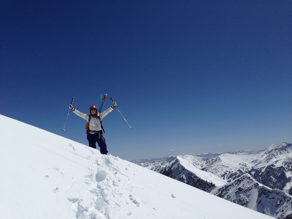

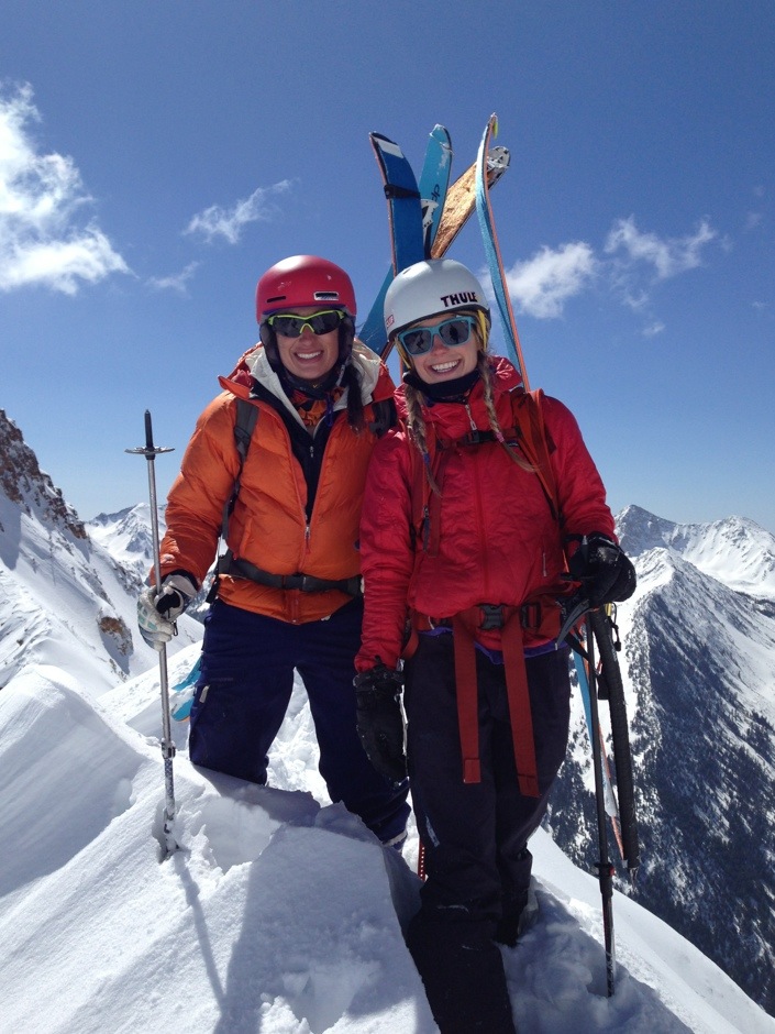
Yah! We made it! We tried not to celebrate too much, because the summit is only the halfway point, especially with a line like this. The views were exquisite. We could see everything from the Great Salt Lake to Lone Peak! For me, the coolest thing about climbing a peak like this is that you can see it from almost everywhere in the valley.
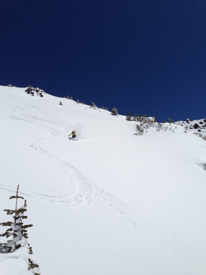
Carolyn Swertka dropping in. The snow was starting to set up, but was still pretty light, especially when we stayed on the skier’s left side of the chute.
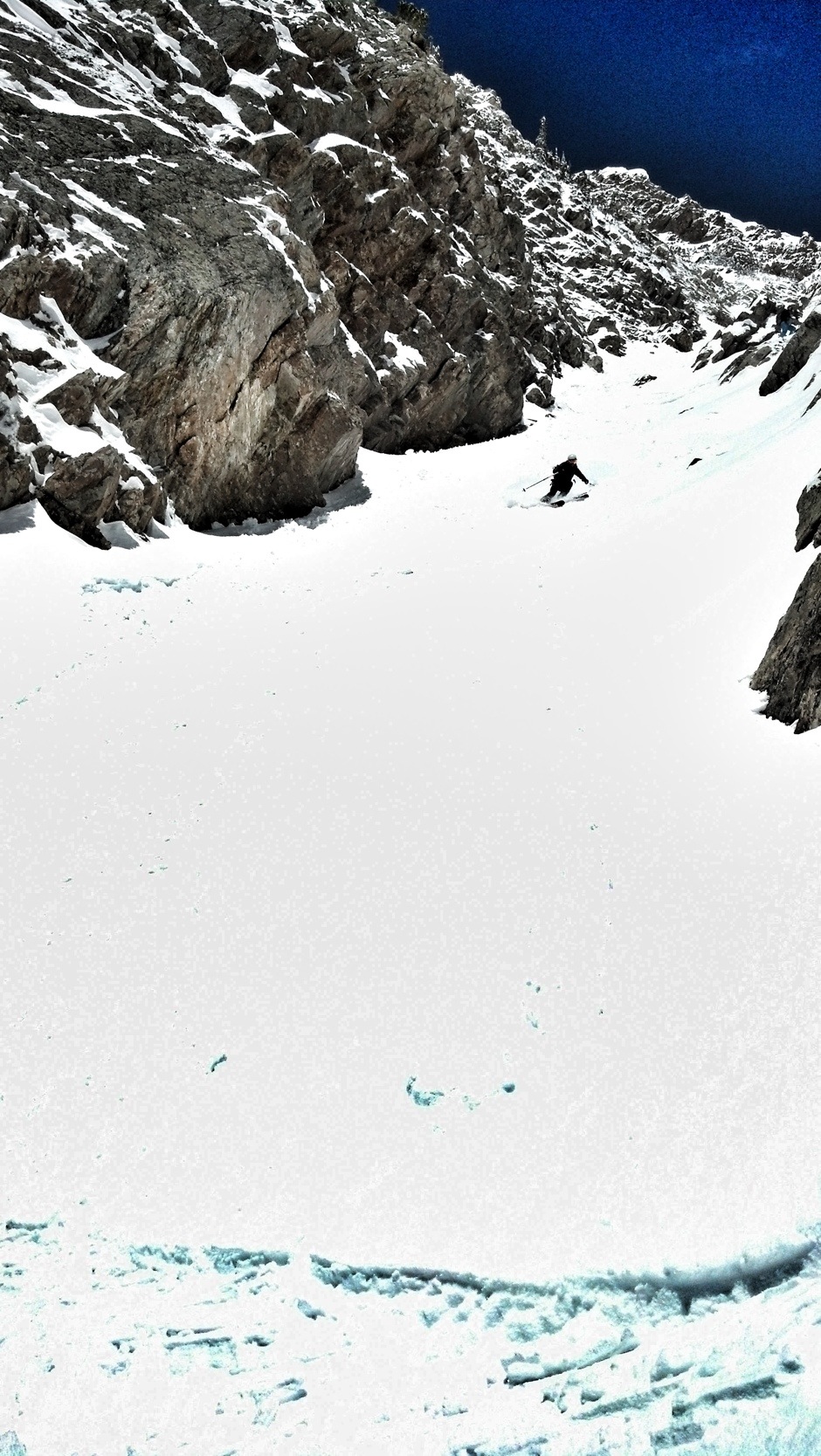
Continuing down, this really is one of the best couloirs in the Wasatch!
Until it turns into this!
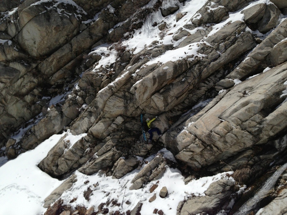
If you look closely, you can see Carolyn rappelling. I thought the fresh snow down low would help the coverage and conditions in the lower part of the line. Turns out, the fresh snow on top of the smooth granite made a very slippery situation. Kind of like a waterslide. We found it easier to set up rappels than downclimb.
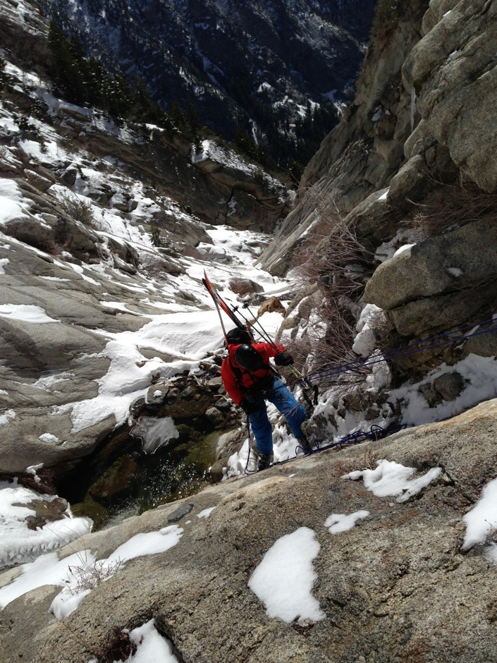
There was a lot of water running through the creek, creating waterfalls and pools. Here, Tobias is rappelling into a knee deep cold pool. Maybe if the water was frozen and the rock was smooth, you could downclimb more easily.
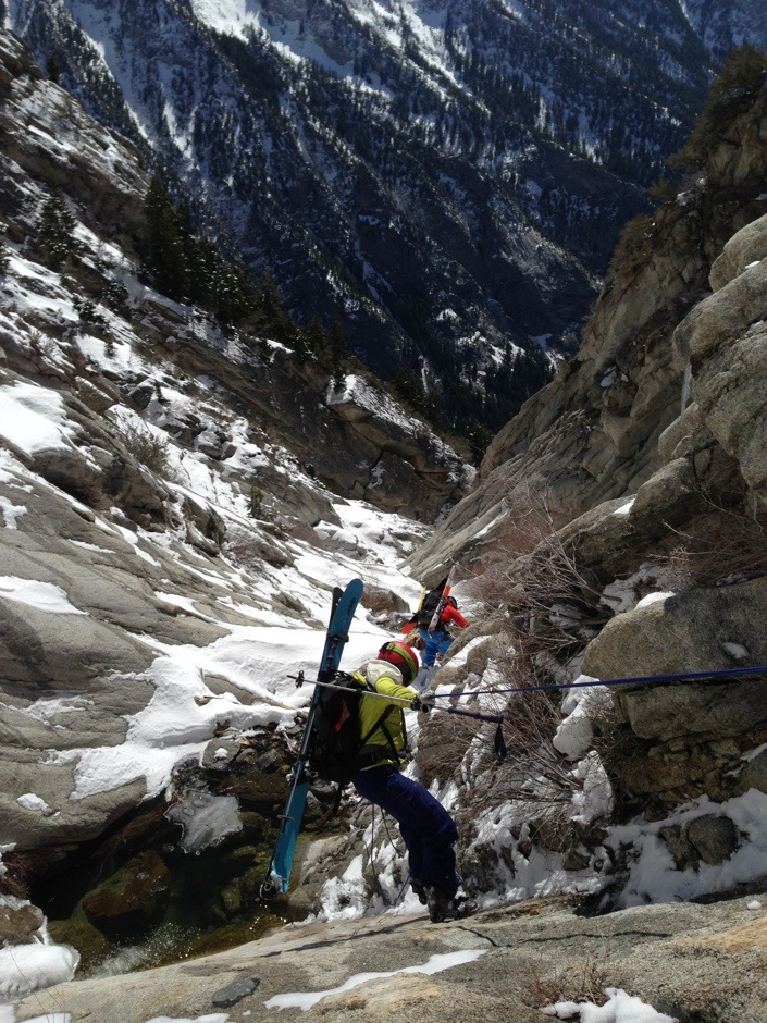
Carolyn following suit.
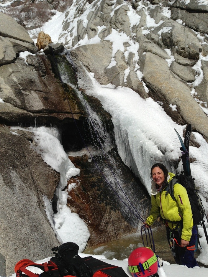
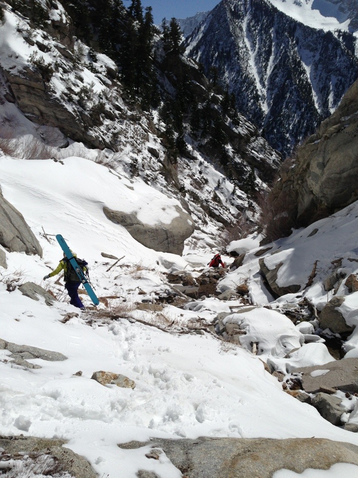
This rappel was fun, an overhanging ice waterfall into a shin deep pool of water. As we lowered, the ice would break away and expose more water. We made sure phones and other electronic devices were secured before taking the plunge. If it were warmer, maybe this would’ve been refreshing. But isn’t that part of the adventure? Carolyn smiles through it all. I called this day, C squared adventure camp (Carolyn + Caroline = C squared). After this rappel, there was another much bigger cliff. We weren’t sure our two 30 m ropes would go. Instead of continuing with the heinousness, I pulled out my iPhone and located us on Goggle Earth (with 1% battery remaining). I had scouted an escape route earlier. I saw we could do a short climb out of the gulch and get to a long slope of pure scrub oak that would put us back on the road. Carolyn put in the bootpack and we were on the way to freedom.
2000′ feet of bushwhacking later, we were back at the car.
Here’s my take on the line – the top couloir is amazing and definitely worth it. This stays filled in most of the winter. If I do it again, I think I will approach from Broad’s, ski the top 2,000′, bootpack back up and ski out the East Couloir of the Twin Peaks. That way you can go fast and light without ropes and harness. The bottom half would need a humongous snow year to get filled in. Even then, it’s questionable.
What I brought for supplies on this day:
5 Clif bar shots
3 Clif bar blocks
3 Clif bars
1/2 egg salad sandwich
1/2 litre Platypus with Nuun
2 12 ounce MFD collapsible water bottles.
Layering top:
Patagonia capilene lightweight merino
Patagonia Houdini
Patagonia Nano Puff
Patagonia Untracked Pullover Gore-Tex Shell
Bottom layer:
Patagonia Untracked Pants – Gore Tex Shell
Other items I brought:
Ortovox Beacon, Probe, Shovel
Petzl Headlamp
Petzl Ice ax
Petzl Harness, ATC, 2 Locking carabiners
Lightweight helmet
Zeal Goggles
Zeal Polarized Sunglasses
2 pairs Leki gloves, one lightweight, one heavier
2 pairs of Toe Warmer packets – I currently have the “hot hands” brand
30 m 7.8 mm rope
iPhone (doubles as camera and map)
2 Voile straps
Skins
Small thing of duct tape
153 cm Nordica Nemesis with Dynafit bindings
Leki Peak Vario S ski poles
So that’s it! Quite an adventure, and a long day. Curious who this Lisa is that Lisa Falls is named after… She must have been quite the lady.